
Urban, city, and county planning are the disciplines of land use planning that explore a very wide, detailed range of aspects regarding the built and social environments of urbanized municipalities and communities.
It has been said that Urban Planning is the "development that improves the long-term social and ecological health of cities and towns." Such planning includes compact, efficient land use; less automobile use yet with better access; efficient resource use, less pollution and waste; the restoration of natural systems; good housing and living environments; a healthy social ecology; sustainable economics; community participation and involvement; and preservation of local culture and wisdom. An important aspect of future planning is a sound understanding of changes that are currently taking place, and the need to modify existing urban and regional institutions to achieve the goals of the plan.
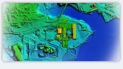
While ortho-imagery enables planners to better view and relate the plan, LiDAR helps to provide more accurate horizontal and vertical maps. Together they provide important data about the land and as-built facilities and how the total current environment may effect future plans. This geospatial data also provides important information to help anticipate and deal with the effects of growth, storms, floods, industrial accidents, etc. LasermapUSA provides the necessary data to support modern urban planning.
|

