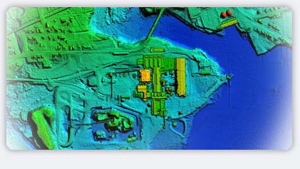

Lasermap has completed thousands of square miles of aerial and LiDAR mapping projects around the world for clients as diverse as utilities, government agencies (both local and federal), land developers, oil and gas exploration companies, engineering firms, and aerial photography providers. LasermapUSA now brings this professional experience and capabilities to the US market.
LasermapUSA, LLC, a U.S. company headquartered in Birmingham, Alabama, was formed in 2005 to bring established Lasermap services to the United States. LasermapUSA proudly joins Lasermap Image Plus of Canada and Lasermap Asia as a member of the worldwide PHB Group.
LasermapUSA is a registered small business with the U.S. Government. The Company adheres to a formal quality control program and is ISO-9001 certified. This, coupled with the professional competence of the entire Lasermap staff, ensures that clients receive exceptional value and the latest in innovation.
Along with aerial and LiDAR data collection and processing, Lasermap employs experienced photogrammetric and analytical professionals making Lasermap an industry leader in remote sensing and mapping services such as cadastral surveying, urban planning, forestry, environmental classification, planimetric compilation, and other GIS applications.
|

