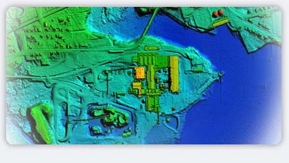

Digital orthophotos require a digital terrain model to rectify the raw photo images into the photomap. Displacement occurs during the collection of raw imagery through a number of phenomena: the attitude of the aircraft when the image was taken, the normal radial distortion from the centre of the lens outwards, and the displacements due to differences in height of the land features below.
The first two distortions can be solved using various techniques of photogrammetry, ground control and, sometimes, inertial systems. However, to correct the latter distortion requires knowledge of the changes in elevation of the ground. Traditionally, these changes have been identified using laborious ground surveys (except in tree covered areas), or photogrammetric compilation, which again can be time consuming, and impossible in some areas.
LiDAR data, acquired remarkably quickly and even in fairly dense vegetation, can penetrate to the ground in places where other methods will not. Besides producing an accurate set of orthophotos, Lasermap can provide a variety of data visualization and interpretation services that add further value to the basic image product.
Lasermap has spent eleven years collecting and processing LiDAR data to build fast and accurate digital terrain models that are then used to produce digital orthophotos that meet or exceed the standards requested by our clients.
|

